Hawkesbury – Wayfinding Masterplan & Interpretive Signage

8th Wonder was appointed to create a wayfinding strategy and interpretive heritage trail, suitable to be applied to the whole of the Hawkesbury LGA.
The Hawkesbury has a rich Colonial Heritage with the 5 Macquarie towns and significant indigenous cultural sites, we drew upon the natural sandstone as the key material relevant to the colonial history and Traditional Owners of the area. Our studio was also engaged to develop interpretive storytelling and roll out the interpretive trail including the project management, fabrication and installation for three town centres.


Strategy Objectives
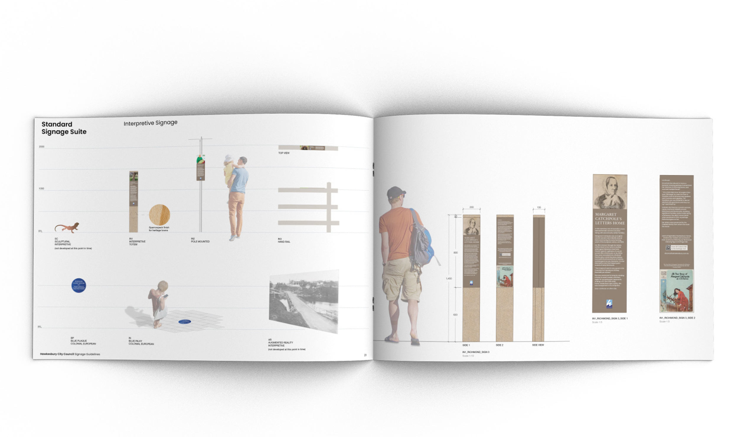
- Develop a visual identity using clear and legible graphic design principles.
- Use iconography and unpretentious language for an inclusive approach to wayfinding and storytelling.
- Increased knowledge about the heritage of the area through incidental interaction with engaging signage.
- Limit the number of signs through optimized location and integration to the environment/streetscape.
- Create contextual and sympathetic design outcomes.


Project Outcomes
- Movement will be an easy, memorable and safe experience.
- Pedestrian-friendly paths and thoroughfares that are safe, comfortable and pleasant.
- Increased walking and improved community wellbeing.
- A better connected community.
- Increased interest in the areas heritage sparked by engaging stories told through signage and easily accessible online content.
- Increased retail event profitability due to more foot traffic and longer stays.

Services
- Strategy
- Concept
- Design Development
- Prototypes
- Documentation
- Site Specific Packages
- Consultancy


Hawkesbury LGA is rich in indigenous and European settlement heritage. During the development of the master plans, a recurring recommendation had been made for signage to include the creation of Heritage Trails through the town centres to highlight and provide information about the rich Indigenous and European history of the area.
Hawkesbury City is named after the Hawkesbury River. The original inhabitants of the Hawkesbury district were the Dharugtribe of Aboriginals, the river, which they called Derrubbin, was a focal point as a source of food and transport. The Dharugpeople used the river to farm for fish, eels, water birds, and mussels. They also used the river as a mode of transport in bark canoes.
It was first settled by Europeans in 1794 in a bid to acquire arable land to feed the increasing population of the penal colony at Sydney. By 1811 Governor Lachlan Macquarie established the five Macquarie Towns in the area. They are Windsor, Richmond, Castlereagh, Wilberforce and Pitt Town. The northern part of the local government area still contains some farmlands and national parkland.

Our studio is collaborating with Hawkesbury City Council and Darug Custodian Aboriginal Corporation to create a suite or heritage interpretation markers applied across the LGA. Each element is tied into a heritage trail and developed to provide insights and deepen understanding across the visitors and local community. The trail insights are also available online and via mobile.